Geography

#BeThePeaceWalk will take place across Rwanda. The country is landlocked situated in the Great Lakes region of East-Central Africa. Also known as ’The Land of a Thousand Hills’. The country lies 75 miles south of the equator in the Tropic of Capricorn, 880 miles ’as the crow flies’ west of the Indian Ocean and 1,250 miles east of the Atlantic Ocean – one would literally say in the heart of Africa! Rwanda is bordered by Uganda to the north, Tanzania to the east, Burundi to the south and the Democratic Republic of Congo to the west.
Anyone visiting ’The Land of a Thousand Hills’ is in for a multitude of surprises. The loveliness and variety of the landscapes in this ’green country’ is dominated by five volcanoes, 23 lakes and numerous rivers and bordered by Lake Kivu to the west.
The Genocide Against the Tutsi took place in all 30 administrative districts of Rwanda, and this has made a convincing case for the #BeThePeaceWalk to cover the whole country.
Rwanda has five provinces: Kigali City, Northern, Southern, Eastern and Western Provinces. A governor leads a province. Each province is divided into administrative districts led by a Mayor (totalling 30 in Rwanda); each district is divided into sectors; each sector into cells and each cell is divided into villages.
Previous visitors leave Rwanda with an extremely keen impression of a spectacularly beautiful, clean, friendly, safe and well-organised country. We hope you will too!
Facts About Rwanda

Population: 10,515,973 people according to the 4th General Census (2012).
Land Area: 26,338 square Kilometres.
The population is predominantly female; 5,451,105 are women corresponding to 51.8% of the total population.
Kigali is the capital city of Rwanda. The city’s geo-coordinates are 157 S, 30 04 E. GMT is +2.
Kigali City population is 1,135,428 people (2012 General Census)
Rwanda has 3 official languages, Kinyarwanda, English and French.
Rwanda’s political system: Republic; presidential, multiparty system.
Rwanda’s National anthem is "Rwanda Nziza" (Rwanda, Our Beautiful)
Rwanda’s currency is the Rwandan franc (RWF).
In Rwanda, cars drive on the right hand side of the road.
Rwanda’s demonym: Rwandan, Rwandese.
Rainfall: Rainy seasons: March - May and October - November (Average of 110-200 mm. per month).
Average Temperature: 24.6 - 27.6ºc.
Hottest months: August, September.
Altitude: Ranges from 1000-4500m above sea level.
Main water bodies: Lake Kivu, Lake Muhazi, Lake Ihema, Lake Burera, Lake Ruhondo, and Lake Mugesera.
Vegetation: ranges from dense equatorial forest in the northwest of the country to tropical savannah in the east.
Akagera National Park was created in 1934. Area: 1080 square kilometers. Altitude: 1250m – 1825m. Rainfall: 750-850 mm/year.
Nyungwe Forest became a National Park in 2004. It has a total area of 1019 square kilometers.
Rugezi Wetlands have a total area of 6735 ha.
Virunga National Park was created on October 1st, 1925. Its total area is 160 square kilometers.
Rwanda is home to 40 per cent of the African continent’s mammals with 402 different species.
Rwanda has a diversity of birds totaling 1,061 species.
Rwanda has 293 species of reptiles and amphibians.
Rwanda has 5,793 higher plant species.
Language
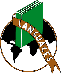
Kinyarwanda is spoken by almost all Rwandans. However, there are 3 official languages: Kinyarwanda, English and French. Kiswahili may be widely understood especially in Kigali, Western south & Western north.
Some simple phrases in Kinyarwanda that will help you get by:
Murakaza Neza Welcome!
Mwaramutse? Good morning (response: ‘mwaramutse neza’)
Mwiriwe? Good afternoon/evening (generally used after about 11am. response is ‘mwiriwe neza’)
Amakuru? How are you?
Ni meza I’m fine
Murakoze Thank you
Ni angahe? How much is it? (A general form)
Yego Yes
Oya No